Two capital cities, two very different safety stories. Washington D.C. reports 40 murders per 100,000 individuals each year. Montevideo’s rate sits at 13.5 per 100,000. The numbers seem clear at first glance. But raw statistics only tell part of the story. Where violence happens matters just as much as how often it occurs. Geography shapes risk in surprising ways. Understanding these patterns reveals what locals actually face when they walk their neighborhoods.
Murder Rates: The Numbers Behind the Headlines
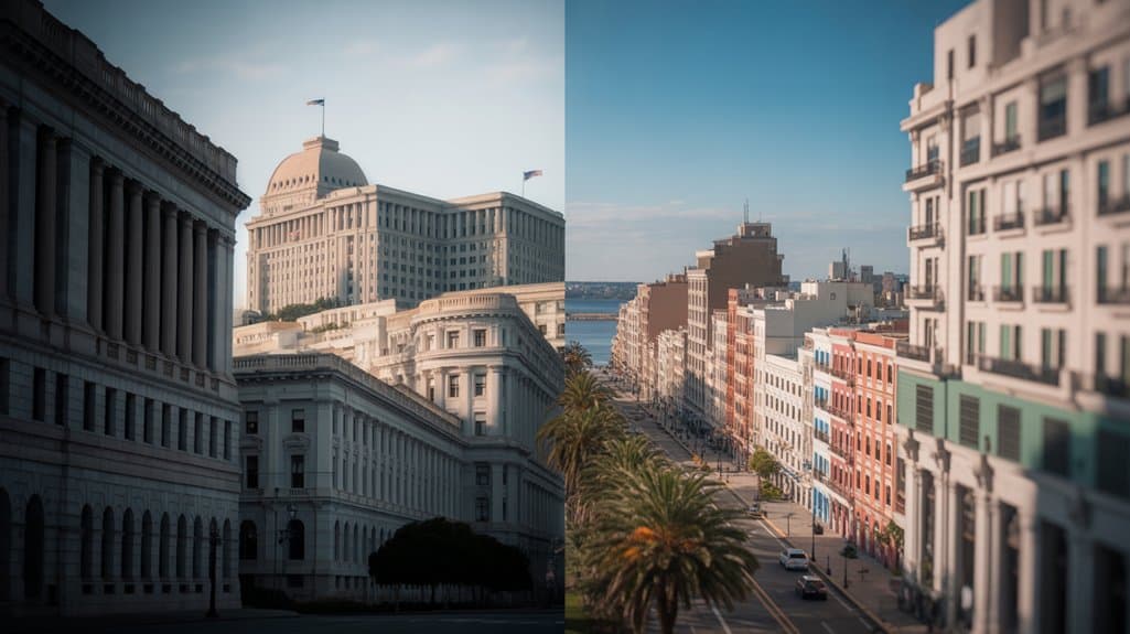
When comparing safety between two cities, the murder rate offers one of the clearest snapshots of danger. Washington D.C. recorded 40 homicides per 100,000 residents in 2023, while Montevideo sits at 13.5. These urban safety statistics reveal a stark difference—D.C.’s rate is roughly three times higher. Murder rate comparisons show D.C. ranks among the most dangerous cities, even compared to many Latin American locations. Montevideo exceeds Uruguay’s national average of 10.7 to 11.2, yet remains significantly safer. The numbers paint a clear picture: your risk varies dramatically depending on which city you call home.
Where Violence Happens: Neighborhood Concentration Patterns
Understanding which neighborhoods face the most violence reveals a critical truth: danger doesn’t spread evenly across a city. These neighborhood dynamics paint different pictures in each location.
In Montevideo, three specific areas—La Paloma/Tomkinson, Casavalle, and Casabó/Pajas Blancas—account for over 30% of murders. One zone reaches 28.1 homicides per 100,000 individuals. These violence hotspots create concentrated risk areas.
Washington D.C. also has dangerous neighborhoods, but the overall rate stays much higher citywide. Even Montevideo’s worst areas don’t match D.C.’s widespread problem. It’s like comparing isolated trouble spots to a larger pattern affecting entire populations.
Historical Trends: How Crime Has Evolved in Both Cities
Over the past fifteen years, Uruguay’s murder rate has doubled—climbing from 6.0 per 100,000 inhabitants in 2003 to 11.0 by 2024. This steady ascent has reshaped safety perceptions across the country. About 56% of these homicides stem from criminal gang conflicts and drug trafficking battles. Meanwhile, Washington D.C. has experienced historical crime waves that peaked at alarming levels. The city’s violent past still influences how residents view their neighborhoods today. Both places show how historical crime patterns create lasting impressions. Understanding these trends helps explain why individuals feel differently about safety, even when current numbers tell only part of the story.
The Drug Trafficking Factor in Uruguay’s Rising Violence
Drug trafficking has emerged as the primary driver behind Uruguay’s climbing homicide numbers. Over half of all murders—around 56%—connect directly to gang conflicts and illegal drug operations. These aren’t random acts of violence. They’re part of organized criminal activity fighting over territory and profits.
Think of it this way: as drug trafficking routes expanded through Uruguay, violence followed. Gangs compete fiercely for control, and that competition turns deadly. This explains why Uruguay’s murder rate doubled in just fifteen years, jumping from 6.0 to 11.0 per 100,000 residents. The pattern mirrors what other South American nations experience when trafficking intensifies.
Measuring Your Actual Risk as a Resident

When comparing statistics between cities, the numbers tell only part of the story. Your actual risk depends heavily on where you live and spend time. Personal safety varies dramatically by neighborhood in both locations.
Washington D.C. residents face higher baseline danger across most areas. Montevideo concentrates violence in specific zones, making avoidance more practical. Understanding local patterns helps you make smarter choices.
Community resilience plays a vital role too. Strong neighborhood connections, active local organizations, and engaged residents create protective layers. These social bonds often matter as much as raw statistics when evaluating true safety levels in your daily life.
Understanding the Scale: Citywide vs. Localized Danger
The difference between widespread danger and isolated hotspots matters more than most individuals realize. City dynamics shift dramatically when violence spreads everywhere versus staying concentrated. Washington D.C. resembles a house engulfed in flames—danger lurks throughout. Montevideo operates differently, with localized violence contained in specific rooms while other areas remain safe.
Consider these key distinctions:
- Washington D.C.’s heightened murder rate affects inhabitants across most neighborhoods
- Montevideo’s danger clusters in three main zones, leaving much of the city peaceful
- Your daily route matters significantly more in Montevideo than in D.C.
Understanding these patterns helps individuals assess their actual safety when visiting or living in either location.
The Temperature Zones of Urban Safety
Safety exists on a spectrum, much like temperatures ranging from freezing cold to scorching hot. Washington D.C. sits in the danger zone, with forty murders per hundred thousand individuals. That’s scorching hot by any measure. Montevideo feels much cooler at 13.5. Urban safety isn’t just about numbers though. Crime perception shapes how inhabitants live their daily lives. Even Montevideo’s hottest neighborhoods stay cooler than D.C.’s average. Think of it like weather zones. One city requires constant caution. The other lets residents breathe easier. Statistical reality confirms this temperature difference clearly.
Statistical Likelihood of Homicide Victimization
How likely is someone to become a victim of murder in these two cities? The homicide statistics paint a clear picture. Washington D.C. residents face a 40 in 100,000 chance of becoming victims. Montevideo’s residents encounter a much lower 13.5 in 100,000 risk.
Key Risk Factors:
- Overall exposure: D.C. presents triple the danger of Montevideo
- Victim demographics: Young males represent the highest-risk group in both cities
- Neighborhood matters: Living in safer zones dramatically reduces your chances
These numbers tell us something important. Your safety depends heavily on where you live. Both cities show concentrated violence in specific areas, affecting certain populations more than others.