Storm Santa Rosa is heading toward Uruguay with serious weather changes on the way. Heavy rains could reach 80 millimeters between Saturday and Monday. Strong winds and thunderstorms will make conditions dangerous across the region. Residents have until Saturday morning to finish their preparations before the worst hits. The smart choices individuals make in the next few hours will determine how safely their families weather this powerful storm system.
Current Conditions and Storm Approach
The calm before the storm is coming to an end across Uruguay. After days of beautiful Indian summer weather with temperatures reaching 28°C, Storm Santa Rosa is heading our way. Many families have been enjoying the warm sunshine, but it’s time to prepare for what’s coming next.
Weather experts are tracking a powerful extratropical cyclone forming in Argentina. This storm system will bring significant changes starting Saturday afternoon. The pleasant 24°C to 25°C temperatures in Montevideo and warmer 28°C readings along the coast will soon give way to much different conditions.
Storm Santa Rosa will affect several key areas across the country. Buenos Aires and western departments of Uruguay will see the earliest impacts. San José, Canelones, and Montevideo inhabitants should pay close attention to weather updates. The storm will likely bring challenging conditions to communities throughout these regions.
What can individuals expect from this weather system? Heavy rainfall, thunderstorms, and strong winds are all predicted. Meteorologists anticipate up to 80 millimeters of rain falling between Saturday and Monday morning. The most intense weather will likely occur Saturday and Sunday evening, so those are the critical times to stay prepared.
This isn’t just a quick passing shower. The storm will last from Saturday through Monday morning, affecting daily routines for many individuals. Schools, businesses, and outdoor events may need to adjust their plans accordingly. Bad weather conditions will probably impact the entire country during this period.
The good news is that storms like this eventually pass. By Monday morning, conditions should start improving across affected areas. Weather patterns suggest calmer days will return after the system moves through.
Right now, families have time to prepare properly. Checking emergency supplies, securing outdoor items, and staying informed about local conditions are smart steps. Storm Santa Rosa follows historical patterns that meteorologists understand well, which helps with accurate forecasting.
Communities across Uruguay have weathered similar storms before. With proper preparation and vigilance, everyone can stay safe while the weather system passes through. Keep watching for updates as Saturday approaches.
Storm Preparation Safety Tips
When is Storm Santa Rosa expected to arrive?
Storm Santa Rosa is forecasted to begin affecting the region starting Saturday afternoon. The weather deterioration will be caused by an extratropical cyclone, with rainfall expected to continue from Saturday through Monday morning. The worst impacts are predicted for Saturday and Sunday evening, so residents should complete their storm preparations by Saturday morning.
Which areas will be most affected by Storm Santa Rosa?
The storm will primarily impact Buenos Aires and the western departments of Uruguay, with specific focus on San José, Canelones, and Montevideo. Northern and coastal regions that are currently experiencing highs of 28°C will see significant weather changes. Bad weather conditions are likely to affect the entire country during the storm period.
How much rainfall should we expect during the storm?
Meteorologists predict rainfall totals of up to 80 millimeters during Storm Santa Rosa. The precipitation will be accompanied by storms, thunderstorms, and strong winds. The heaviest rainfall is anticipated during Saturday and Sunday evening, when the extratropical cyclone will be at its most intense over the affected regions.
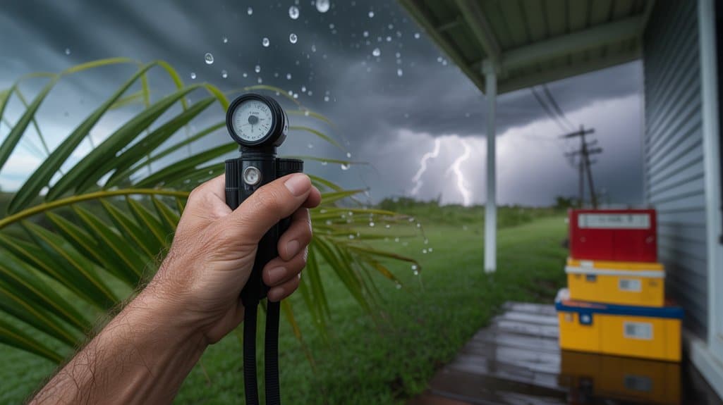
What emergency supplies should I prepare for the storm?
Essential storm supplies include non-perishable food for at least three days, bottled water, flashlights, batteries, a battery-powered radio, first aid kit, medications, and phone chargers. Since the storm may cause power outages lasting from Saturday through Monday morning, ensure you have enough supplies to last the entire duration without electricity or access to stores.
How should I prepare my home before Storm Santa Rosa arrives?
Secure outdoor furniture, trim tree branches near your home, check and clean gutters, inspect your roof for loose materials, and ensure windows and doors are properly sealed. Given the expected strong winds and up to 80 millimeters of rainfall, take time to identify potential water entry points and address them before Saturday afternoon when conditions begin to deteriorate.
Should I avoid travel during Storm Santa Rosa?
Travel should be avoided during the storm period, especially on Saturday and Sunday evening when conditions will be most severe. The combination of heavy rainfall, thunderstorms, and strong winds will create dangerous driving conditions. If travel is absolutely necessary, avoid flooded roads and allow extra time for your journey while monitoring weather updates continuously.
When will weather conditions improve after the storm?
Storm effects are expected to subside by Monday morning, with potential for weather improvement after the extratropical cyclone passes through the region. However, residents should continue monitoring meteorological updates for any changes in the forecast. The current Indian summer conditions with temperatures reaching 28°C are expected to return once the storm system moves away.
What should I do if I lose power during the storm?
If power outages occur, avoid using candles due to fire risk and instead rely on flashlights and battery-powered devices. Keep refrigerator and freezer doors closed to maintain temperature, unplug electronic devices to prevent damage from power surges, and never use generators, camp stoves, or charcoal grills indoors. Report outages to your utility company and conserve phone battery for emergencies.
How can I stay informed about Storm Santa Rosa updates?
Monitor local meteorological services, emergency management agencies, and weather radio broadcasts for real-time updates about the extratropical cyclone’s development. Social media channels of official weather services provide frequent updates about storm intensity, timing changes, and safety recommendations. Keep devices charged and have backup power sources available for continuous access to storm information.
What are the signs that I should seek immediate shelter?
Seek immediate shelter when experiencing rapidly intensifying winds, heavy rainfall that reduces visibility, frequent lightning, or tornado warning sirens. During Storm Santa Rosa’s peak intensity on Saturday and Sunday evening, avoid windows, stay in interior rooms on the lowest floor, and be prepared to move to a safe location quickly if conditions worsen beyond the predicted thunderstorms and strong winds.
Post-Storm Recovery Planning

Once Storm Santa Rosa passes through on Monday morning, families and communities will begin the important work of getting back to normal. The first step involves checking everyone’s safety and reaching out to neighbors who might need help. Many individuals will need to clear fallen branches and check for damage around their homes.
Having a simple plan makes everything easier. Keep important phone numbers handy for repairs and insurance. Take pictures of any damage before cleaning up. Remember, working together as a community helps everyone recover faster and stronger than before.